Construction of compounds, haul routes and commence clay imports
Need help finding something?

PROJECTS
Benacre & Kessingland Flood Management Project
Services
Civil Engineering
Natural Flood Management
Coastal Engineering
Location
Benacre, Nr Beccles, Suffolk
Partners
Delivered by:
Balfour Beatty, Stantec, Gleeds,
Funded by:
Environment Agency, Anglian (Eastern) Regional Flood & Coastal Committee, Suffolk County Council, East Suffolk Council & Sizewell C
In partnership:
Benacre Estate, Parkdean
Project Programme
Spring 2025 – Summer 2030
Project Overview
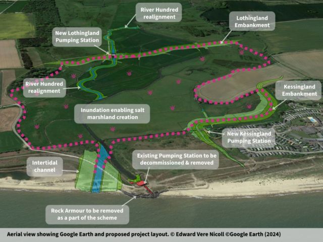
The Benacre & Kessingland Flood Management Project aims to reduce flood risk in Kessingland and the Lothingland Valley while delivering wider environmental and community benefits. Construction began in Spring 2025 and is expected to finish by Summer 2030.
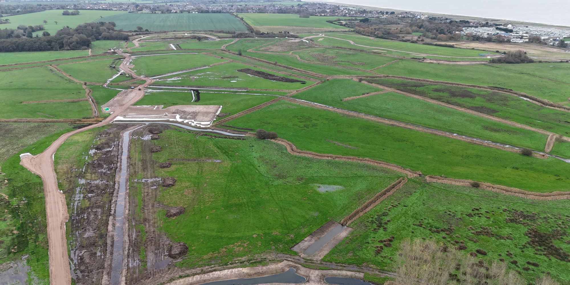
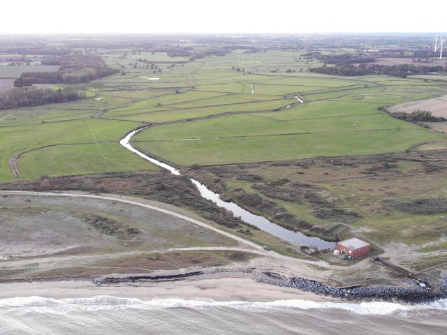
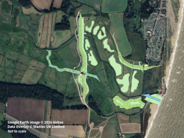
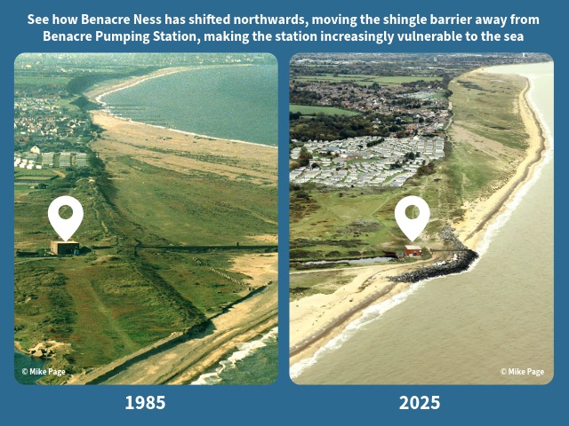
Originally built in 1955, the Environment Agency’s 70-year-old Benacre pumping station near Kessingland has exceeded its lifespan. Adding to these concerns, the Benacre Ness sand and shingle ridge that has historically protected the station is steadily moving north, leaving it exposed to coastal erosion. To tackle this urgent issue, the realignment scheme will construct inland flood defences, including;
- An embankment spanning the Lothingland Valley to manage tidal flooding and a pumping station to manage river levels.
- An embankment around Kessingland’s Parkdean Resorts to manage tidal flooding and a pumping station to manage surface water for the village.
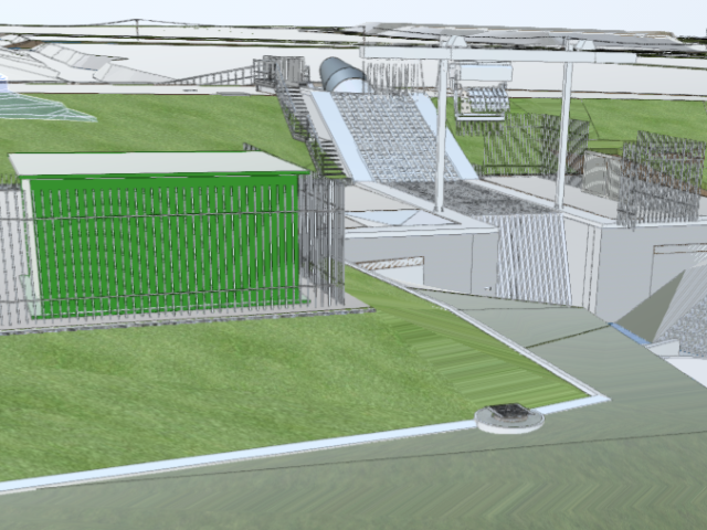
The Lothingland station features three 3 meter diameter Archimedes screw pumps that will lift water 4.5 meters over the flood embankment. The flow rate will be as low as 0.75m³/second up to full capacity of 10.2m³/second. This is more than double the current stations capacity accounting for climate change predictions for intense rainfall events. The Kessingland station features one 2 meter diameter Archimedes screw pump that will lift water 4.5 meters over the flood embankment . This replaces a gravity discharge from the village of Kessingland improving water level management back to the village.
The project will be completed by decommissioning and demolishing the ageing Environment Agency pumping station.
Benefits
The Benacre & Kessingland Flood Management Project will provide lasting value to both the local community and the natural environment.
- Protecting 35 homes, 46 businesses and 600 hectares of farmland from tidal, fluvial and surface water flooding.
- Securing vital infrastructure, such as the A12, to support the resilience of the regional economy.
- Providing job opportunities and local business involvement during the construction phase.
- Creating over 50 hectares of intertidal marsh to support wildlife and act as a carbon sink.
- Enhancing 52 km of river habitat by removing barriers to eel migration.
- Safeguarding 11 million cubic metres of freshwater, protecting habitats and agriculture.
- Undergrounding of 1.8km of overhead power lines within the ‘Suffolk and Essex Coast and Heaths National Landscape’.
By combining engineering innovation with environmental restoration, the project ensures long-term flood protection for Kessingland, the Lothingland Valley and the surrounding area.
Project Newsletters & Communications
Benacre General Arrangement Plan - February 2026
DownloadBenacre Newsletter - November 2025
DownloadBenacre Newsletter - April 2025
DownloadBenacre Newsletter - October 2024
DownloadBenacre Newsletter - May 2024
DownloadPublic Consultation Information Pack - July 25
DownloadTraffic Management Link
Go to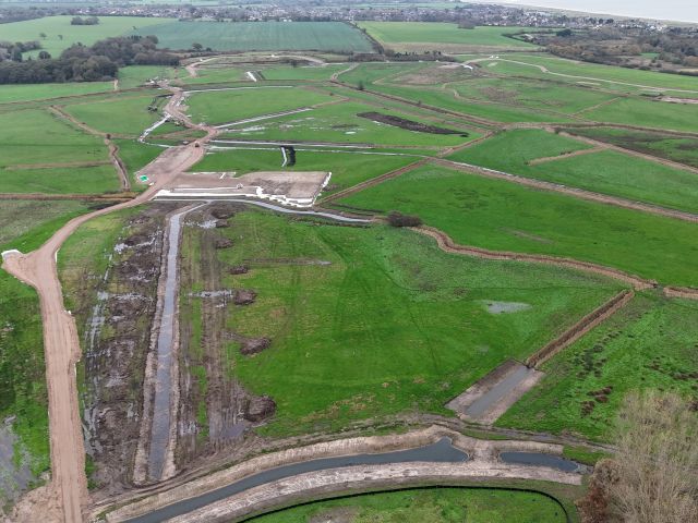

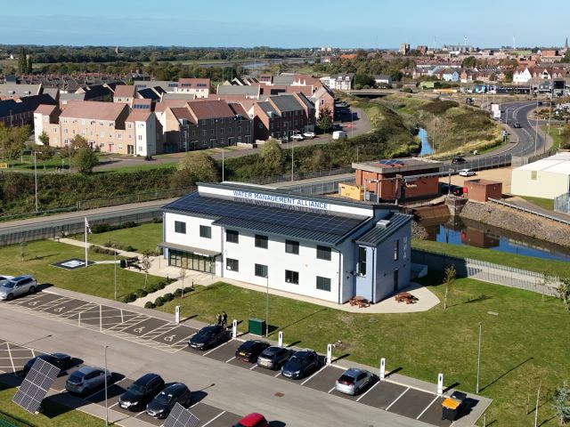
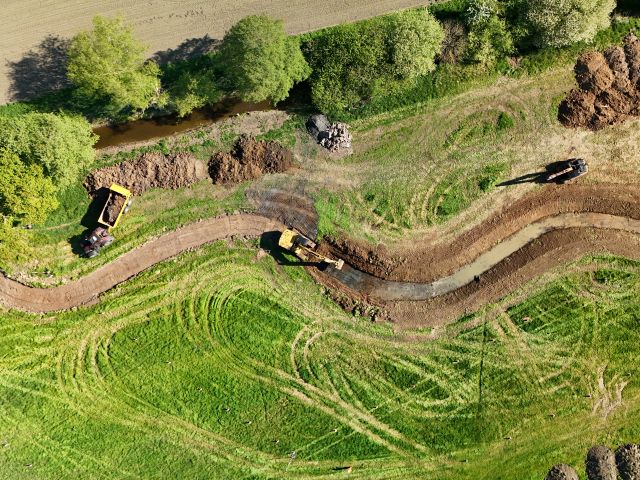
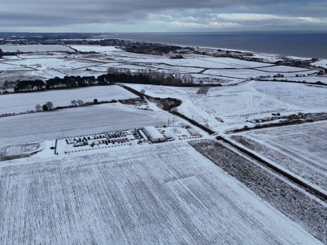
An aerial overview of the Project so far (2025)
Project Gallery

Go to previous slide
Go to next slide
Project timeline
2025
2026
UK Power Network works (Phase 1), initial embankment construction, pumping station sheet piling & construction
2027
Further embankment construction, pumping station construction and excavation of river
2028
Pumping station commissioning and intertidal channel works
2029-30
Complete demolition of old Benacre pumping station and recovery of rock, remove haul routes and compounds
History of Benacre Ness
Benacre Ness is a large, mobile sand-and-shingle foreland that has gradually migrated north along the Suffolk coast for centuries, making it one of the most dynamic coastal features in the region. Early maps from the 16th to 18th centuries show a protrusion several kilometres south of its current position, sometimes labelled Easton Ness. More reliable 19th-century mapping captures the feature near Covehithe, later renamed Benacre Ness and from this point onward its steady northward movement becomes clearly documented.
Aerial photography shows that Benacre Ness has continued to reshape itself and the coastline, elongating and advancing more than 1.5 km at its leading edge while its southern edge has eroded more slowly. Its associated offshore shoal, known as Barnard Bank, plays a key role in local sediment circulation and supports the ness’s continued migration.